Quick Access
This article includes multiple key features that help users visualize their data by overlaying it on the map.
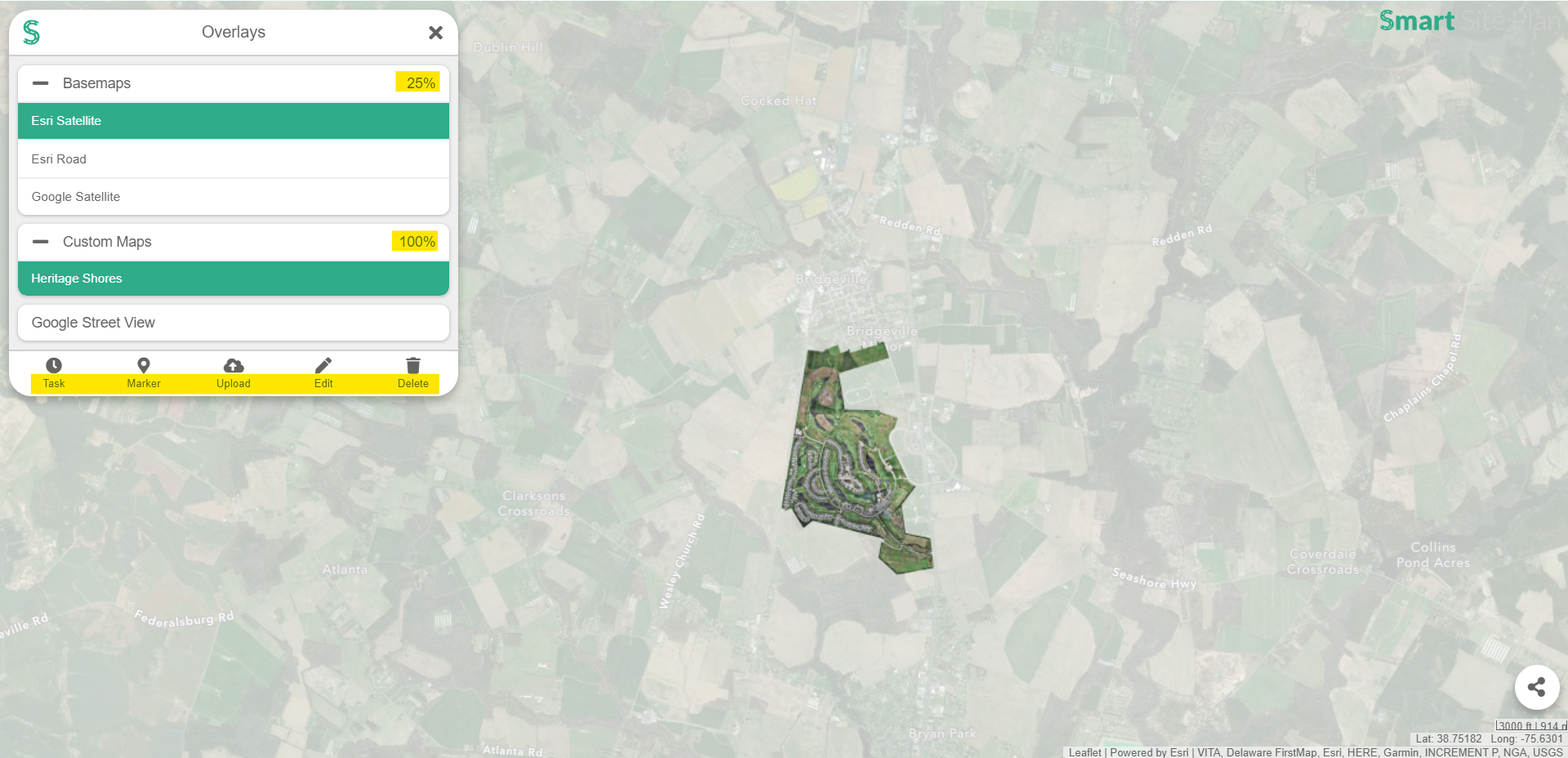
 Notice one map layer is more defined against the other map overlay.
- To the right side of the Overlays panel are percentage values that indicate the level of visibility for that overlay.
- When this percentage value is clicked on it will adjust the amount of opacity for that particular overlay.
Overlays currently includes six features that help users visualize their data.
Basemaps
Are the maps that cover the entire world. If you would like to learn more, check out our Basemaps article.
Custom Maps
Are tiles that can be sourced or uploaded. If you would like to learn more, check out our Custom Maps article.
Images
Can be uploaded by the user and manipulated over any area on the map. If you would like to learn more, check out our Images article.
Markers
Are points on the map that can be created to help with project management and navigation. If you would like to learn more, check out our Markers article.
Tasks
Are reminders that can also be linked to a point on the map. These tasks are colored-coded and have an alert system to create awareness of deadlines. If you would like to learn more, check out our Tasks article.
Google Street View
Allows users to navigate our maps in street view. If you would like to learn more, check out our Google Street View article.
At the bottom of the Overlays panel is a taskbar equipped with functions designed to customize your overlay features.
- Task allows users to create a new task. If you would like to learn more, check out our Tasks article.
- Upload allows users to Custom Map Tiles and Images. If you would like to learn more, check out our uploading Custom Maps and Images articles.
- Link allows users to add web-accessible tiles to their project. If you would like to learn more, check out our Linking Custom Maps article.
- Marker allows users to create markers for their projects. If you would like to learn more, check out our Markers article.
- Edit allows users to customize their Custom Maps, Images, and Tasks. If you would like to learn more, check out our editing Custom Maps, Images, and Tasks articles.
- Delete allows users to remove their Custom Maps, Images, and Tasks. If you would like to learn more, check out our deleting Custom Maps, Images, and Tasks articles.