This release introduces the new Forms and updates Search, Basemaps, and Google Street View.
Forms
Has been fully rebuilt to provide an increase in productivity, user flexibility, customization, sharing, searching, and downloading! To learn more, visit the new Form’s article.
Search
Now supports the new Forms. Users can directly find, download, and use forms here without navigating to the Form’s container. To learn more, visit our Form’s article. In regards to Places, Smart Site Plan now uses Esri geocoding instead of Googles. This is to fully comply with Google Maps API. Additionally, selecting a result in Places leaves a marker behind with useful information. If there is Google Street View data available for the selected place, the Google Street View row will show containing the URL link.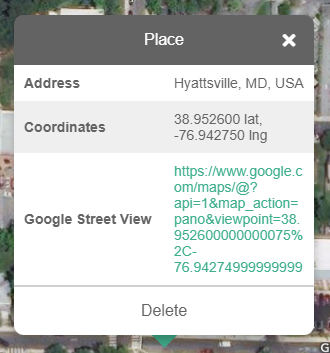
Basemap
Google Satellite has been removed from the available Basemaps. See Google Notice to learn more.
Google Street View
Now opens up an external page in Google Maps when a place with available Google Street View data is clicked. Also, a marker is left behind with the visited URL anywhere a successful Google Street View attempt was made. To learn more, go to the Google Street View article.
Google Notice
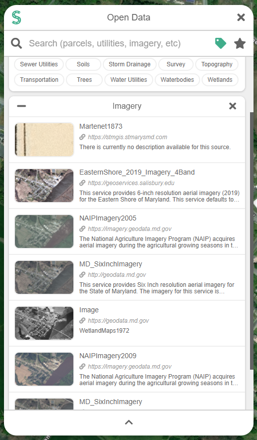
Google Satellite Basemap is no longer supported in Smart Site Plan. In order to be compliant with Google Maps API, we could not use their Imagery and Places with other overlaying maps. Since Smart Site Plans core is built around overlaying maps, the compromise is not possible. The good news is Open Data, in Smart Site Plan, gives users the ability to use publically available imagery directly in their project. To learn more, go to the Open Data article.
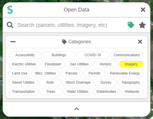
- Navigate to Open Data.
- Select Imagery.
- Find imagery that enhances your project’s map. You can also Favorite the source for future use.